Context:
I. The River Volga
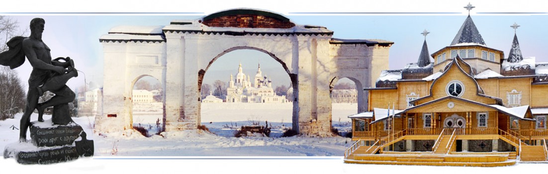
II. Old Maina
III. New Maina
IV. Maina
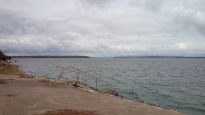
V. Manych
In the middle course of the Volga River there are two rivers Maina and several settlements bearing this name. All of them have 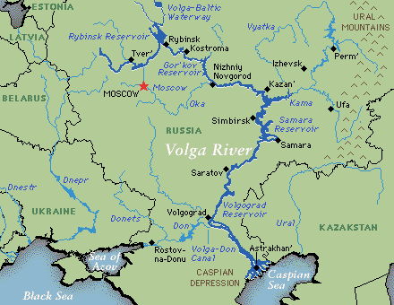 historical and sacral values described in the below sections of this work. They are largely based on the Volga, being a spiritual gift from Creator.
The Volga (3,692 km long) is one of the largest rivers on Earth and the largest in Europe. The Valdai in Tver region (Central Russia) is the origin of the Volga. Its mouth is the Caspian Sea. 11 of 20 largest cities of Russia, including its capital, Moscow, are located in the Volga’s watershed.
Along the Volga are located some of the largest reservoirs in the world. For example, Rybinsk Reservoir in the upper Volga. Interestingly, the city of Rybinsk is the birthplace of the founders of the Hollywood and the Russian residence of the Sweden born Nobels who made their fortune in Russia (including Baku oil), but best known for the Nobel Prizes.
The Volga is a great Russian river and has a special significance in Russian culture. It is often referred to as Mother Volga, the spiritual foundation of a multinational and multicultural Russian civilization, whose purpose is to be a spiritual beacon for the world.
Jose Arguelles has pointed out that ‘Rus’ (another name of Russia) is the ancient name of the force of harmonious ordering of phenomena. He is the man responsible for turning the eyes of the world to the Ancient Maya, and the profundity of Galactic Time Science and the father of the Harmonic Convergence of 1987 that was the key event for spiritual life of the planet and far beyond.
The magazine “World Channeling” No. 2 (27) 2016 provides interesting information about the common origin of the names of the Volga River and the country of Russia. It goes back to Lemuria. In those distant times the word ROUS meant CARRYING LIGHT, ENERGY CENTER, SPREADER OF ENERGY. Later, during the time of the Eurasian Hyperborea, the ROUS was the name of the river which is now known as the Volga. The city of Borea, the capital of Eurasian Hyperborea was also in the middle course of the Volga, on the territory of modern-day Kazan. This Eurasian Hyperborea was founded 8000 years ago the descendants of the Atlanteans who lived in the territory of modern Egypt. Kazan located on the Volga River is still Russia’s champion for the pyramids. The largest of them is a copy of the Great Pyramid in Giza.
Thus, the ancient Lemurian meaning of the word RUS and ROS is CARRYING ENERGY, ENERGY CENTER. The sound of OU during the time of Lemuria was not divided. Later, the sound OU was transformed either into a sound U, or into the sound O. In some words, these sounds alternate. That is why the words ROSSIYA (Russia) and RUS are simultaneously used. Lemurian language still exerts its influence on the Russian language.
Hence, the special task of Russians to learn how to feel harmoniously, develop the culture of their emotions and become the ROUS of LOVE or RUS of LOVE, the energy centers of love, which elevates all people to their Spiritual Motherland, the Motherland of Unconditional Love in the heart of the One God-Creator. There Love is one and inseparable. It is a special sacred center, the source of Love, the original energy of the highest sense. In English, the word HOME means a shelter, but even during the time of Lemuria it was known that HOUME is the heart of the God-Creator of the Universe. The connection with the Lemurian language is closely preserved in many languages of the world.
Old Maina (Russian: Staraya Maina) is an urban type settlement and the administrative center of the Old Maina district (Russian: 
Staromainsky raion) of Ulyanovsk region of Russia. It is located in the Volga Federal District. Its administrative center is the city of Ulyanovsk.
The Ulyanovsk region is the birthplace not only of Lenin (the symbol of Russian 1917 revolution that changed the world), but also of Russian writer, historian and critic Nikolay Karamzin (1766–1826), who is called the “father of Russian history” for his “History of the Russian State”, a 12-volume national history.
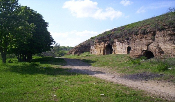
Old Maina claims to be the most ancient rural settlement in Russia. According to Ulyanovsk archaeologists, people on the territory of the present Old Maina have lived continuously for 1700 years. However, the oldest finds discovered on the territory of Old Maina are 20,000 years old. The territory of Old Maina and its surroundings are called archaeological Eldorado. As per the saturation of cultural heritage sites and their value, this area is unrivaled in the Ulyanovsk region, although the oldest part of Old Maina was flooded by the Kuybyshev Reservoir, sometimes called Samara Reservoir, created in the middle of the 20th century. It is the largest reservoir in Europe and third in the world by surface area.
The oldest artifacts found by archaeologists during the excavations in Old Maina, confirm the hypothesis of scientists that in the times of ancient Rus people began their movement from here (the Middle Volga) to the west to the rivers Don and Dnieper, mastering new territories, building new settlements, so was built the city of Kiev, now the capital of Ukraine. 1700 years ago Old Maina was a densely populated city with around 80,000 residents. Hense, Old Maina is much older than Kiev that is still considered one of the oldest cities in Russia, the mother of all Russian cities.
Historians and linguists know the lines from the oldest part of the Indian Vedas, the Rig-Veda, written in Vedic Sanskrit: “Itham ascati pasyat syantham, ekam starayath mainaa-kaalam” that is “There the holy rivers flow, the places are called Old Maina”. The Vedic phrase «starayath mainaa» is literally the Russian name of Old Maina — Staraya Maina…
Indeed, in the Rig-Veda are listed the names of dozens of holy rivers, on the banks of which the noble Vedic poets (Rishis) compose sacred hymns to the gods of the Rig-Veda. The Aranya Parva, also known as the “Book of the Forest” of Mahabharata (originally composed in Classical Sanskrit evolved from Vedic Sanskrit) has couple of hundreds names of the holy rivers (ponds) of Kurukshetra (the ancient Aryan land of Bharat) that cleanse a person from sins, after bathing in them. Interestingly, many of the Russian rivers of the Volga – Oka basin have preserved to this day their ancient names, given in the major holy ancient texts preserved in India.
The prominent researchers of ancient ties of Russia and India, point out that Russian language and Vedic Sanskrit are unusually close to each other, despite the millennia of their original way of development in Russia and India. The reason for this kinship is obvious. Both languages have one source of origin that is the Aryan language or Vedic Sanskrit of the Rig-Veda. Strong support for this also provides DNA-genealogy and huge number of Russian toponymy translated from Sanskrit. The Vedic names in the modern-day Sind province of Pakistan (the cradle of Vedic civilization of Hindustan) are similar to those in Russia. Most evident example is Karachi.
Vedic Sanskrit is not a dialect, but a complete and grammatically complex language. It is believed that all Indo-European languages have grown up from Vedic Sanskrit, including various and numerous dialects of the Slavic, Old Russian language. Sacred vocabulary is the basis of the Russian language. Indian sages well know that the Golden Age will begin in Russia.

Ancient Vishnu idol was found in Old Maina in 2007. Later that year, an international conference was organised to study the legacy of Old Maina. Surely, it might radically change the history of ancient Russia.
Based on the archeological findings, Old Maina can be recognized as the initial motherland of the Russian people and cradle of Russia. This brand will glorify Ulyanovsk region more than the status of the “homeland of Lenin”, who was born in Ulyanovsk in 1870.
The direct distance from Old Maina to Ulyanovsk is 45 km. By car it is less than 70 km. The road passes international Ulyanovsk Vostochny Airport that has the longest and the widest public use runway in the world. The airport is connected to the local state owned Aviastar plant, the largest aviation production facility in the world and one of the newest in Russia. Among the plant’s products  are: the An-124 long-range heavy transport aircraft, the 200-seat Tu-204 medium-range airliner, modernized Il-76, etc.
Until the Boeing 747-8F, the Antonov An-124 or RUSLAN was, for 30 years, the world’s heaviest gross weight production cargo airplane and second heaviest operating cargo aircraft, behind the one-off Antonov An-225 (a greatly enlarged design based on the An-124). The An-124 remains the largest military transport aircraft in the world.
The Ilyushin IL-76 has seen extensive service as a commercial freighter for ramp-delivered cargo, especially for outsized or heavy items unable to be otherwise carried. It has also been used as an emergency response transport for civilian evacuations as well as for humanitarian aid and disaster relief around the world. It is able to operate from unpaved runways and is used in many countries of the world.
The modernized IL-76 (IL-76MD-90A) now produced in Ulyanovsk has no analogues in the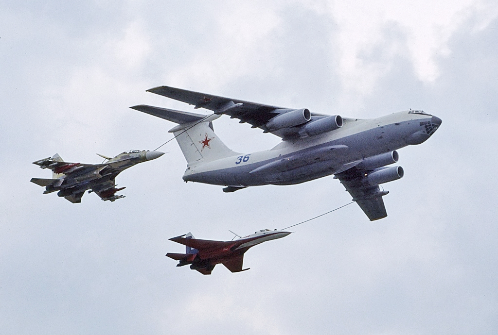 class of ramp vessels in the world. It can be operated in any climatic conditions with almost no restrictions. It could be used in various fields: as a military transport aircraft, aerial refueling tanker or command center, for extinguishing fires, etc. IL-76MD-90A is more unpretentious in comparison with the western one. It does not need a special infrastructure, and it does not need constant significant maintenance. They intend to create also a civilian version of the aircraft.
IL-76 and its modifications have been designed by the Ilyushin design bureau founded by Sergei Ilyushin (1894 – 1977) born near Vologda. He was the youngest of 11 children in a peasant family. Being largely self-taught, Ilyushin left home at an early age for Saint-Petersburg. He became an outstanding Soviet aircraft designer, the developer of the most massive combat aircraft in history (the IL-2 attack aircraft) rightfully considered the best attack aircraft of the Second World War. His IL-4 and IL-28 were the outstanding bombers. Being over 80 year old, Ilyushin Design Bureau has been leading not only in Russia, but also in the world. Ilyushin is the Russian presidential aircraft (board number one).
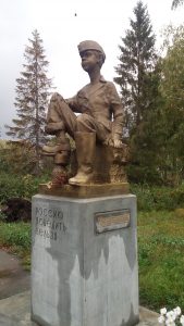 In Old Maina there is a monument dedicated to the children who worked as hard as the adults during the World War II to crush the Nazis. On that monument it is written that Russia can not be defeated.
By the order of Russian Tsar, fortress of Maina was founded in 1670 on the left bank of the Volga River, in  the mouth of local river Maina. According to Ulyanovsk archaeologists, in the territory of the present Old Maina people have been living continuously since the 3rd – 4th century. The tribes of Imenkovo archaeological culture came first here. Many official researchers regard Imenkovo culture as the Slavs. More profound results on the ancestors of the Slavs provide DNA Genealogy studies. They prove that the ancestors of the Slavs are the Aryans. It is also true for other nations living in the Russian Plain, Siberia, Central Asia, India, Iran, etc.
The ancient authors of the first centuries called the Volga as Ra. This is a very multilevel name. RA is the Sun of the Outer World, whereas AR is the Sun of the Inner World. Hence, the names Ariya and Aryan. In Sanskrit, Ra means fire. Ra is the ancient Egyptian god of the Sun. Ra is also one of the islands of Vanuatu (lit. “The land of happiness”).
Imenkovo culture was first discovered in village Imenkovo (Tatarstan), 100 km northeast of Old Maina, where river Kama meets the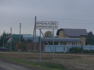 Volga. Both names are translated from Sanskrit. Imenkovo culture existed on the territory of the present Old Maina for about 400 years. The next five centuries the local lands were owned by the Volga Bolgars. Then these lands were conquered by the Golden Horde (Orda). After the collapse of the Golden Horde, the land was under the Kazan Khanate. In the second half of the 17th century the first Russian settlement from Moscovia appeared here.
Unique archeological objects have been discovered on the territory of Old Maina. For instance, Gothic-type pendants dating from the 3rd century, coin of the Roman emperor Caracalla (dated the year of 213), etc. Each year more and more such rarities are found. On the territory of Old Maina they have found things connected with the Slavs, with the Balts, and even with the ancient Germans.
The remains of long houses, up to 25 meters in length, of German-type houses have been found on the land of Old Maina. Later, such houses appeared in the Vikings. The name of River Maina in Russia (tributary of the Volga) and the River Main in Germany (tributary of the Rhine) are genetically related. DNA genealogy shows that over 25% of modern male Germans have the same male ancestor with over a half of the Russian men. It is well known that large parts of Germany were populated by the Slavs. Their forceful 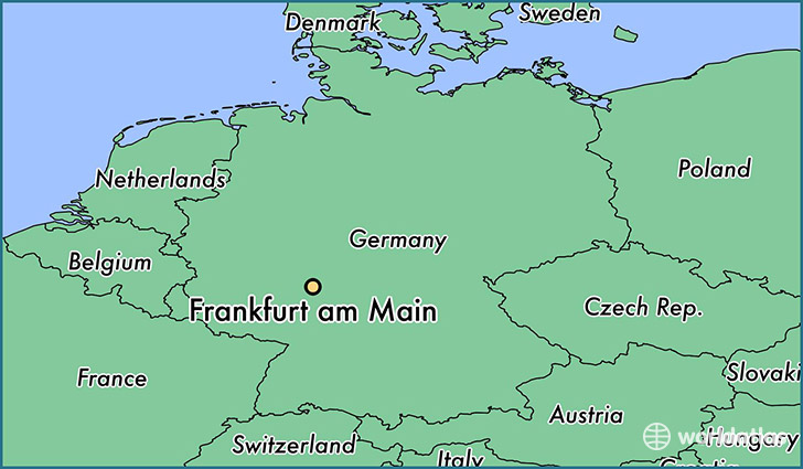 Germanization or extermination started approximately in the 12th century, when the Danish feudal lords destroyed the ancient Slavic sanctuary of Arkona, located on the island of Ruyan (German Rügen) in the Baltic Sea.

Frankfurt on the Main
The Main River (525 km) is also the longest river lying entirely in Germany. The largest city along the Main River is Frankfurt on the Main in the German state of Hesse, historically related to the Russian Imperial House of the Romanov and the founder of the most powerful family of Rothschild. Frankfurt is the major financial centre of the European continent. Messe Frankfurt is one of the world’s largest trade fairs. The Frankfurt Motor Show is the world’s largest motor show. The Frankfurt Book Fair is the world’s largest book fair. The River Main originates at the joining of its two headstreams, the Red Main and the White Main. The red and white are the colours of the flag of Frankfurt. They also symbolize the global mystery started in Ancient Egypt and centered today in the Russian town of Veliky Ustyug.
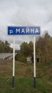
The wide mouth of River Maina near Old Maina is formed by the Volga’s water.
Archaeologically speaking, first settlers of the Middle Volga and Old Maina were the Imenkovo tribes, the first farmers in the Volga region. To date, scientists have identified more than 600 settlements and cemeteries of the Imenkovo culture. They were engaged in farming and cultivated millet, pound, wheat, barley, oats, peas, rye. A cattle breeding was very developed. The Imenkovo tribes bred horses, large and small cattle, and pigs. They had the processing of iron and bronze. Often are found iron plows, sickles, etc.
According to some sources, the Imenkovo tribes are considered to have come from the territory of modern Poland, Germany and Austria. Others believe that they came from the modern Ukraine. Exact answer on the ancestors of Imenkovo, and other tribes on the Russian Plain, the rest of Europe, and Siberia, provides DNA genealogy. Most importantly, the Ulyanovsk region is the only region that was completely the zone of settlement of the Imenkovo tribes. Neighboring regions were partly occupied by the Imenkovo culture. It was present only on their edges.
It has been substantiated that after the arrival of the Bolgarians in the Middle Volga region from the region of Azov Sea in 7th century, most of the Imenkovo culture bearers left to the southwest, where they became the nucleus of Volyntsevo culture (8th – 9th century) spread in the interfluve of the rivers Dnieper and Don. The village of Volynskoe (now part of Moscow) was the place of Stalin’s beloved residence. He died there in 1953.
In Kiev, layers of Volyntsevo culture are found in the most ancient places of the city, including the Church of the Tithes, the first  stone church in Kiev, built in the end of 10th century by the order of Grand Prince Vladimir the Great, who Christianized the Kievan Rus. Kiev was the main center of Christianization of other parts of Rus (Russia). Hence, it was called “mother of Russian cities” in Greek manner. The Greeks (from Byzantium) took the most active role in spreading Christianity in Russia. The expression “mother of Russian cities”, as well as the Greek “metropolis” (from “meter” – “mother” and “polis” – “city”), means the founding city. In Russian language, Kiev is a male name. Kiev reached its Golden Age as the center Kievan Rus in the 10th — 12th centuries.
The non-legendary time of the founding of the Kiev is hard to ascertain. They say that Kiev is at least 1,200 years old. In Ulyanovsk region, Old Maina is 1,700 years old. However, the oldest Russian settlement is considered to be Tolbukhino (over 4,000 years old) near Yaroslavl, founded by Yaroslav the Wise (circa 978 – 1054), thrice grand prince of Veliky Novgorod and Kiev, uniting the two principalities for a time under his rule. His descendants were 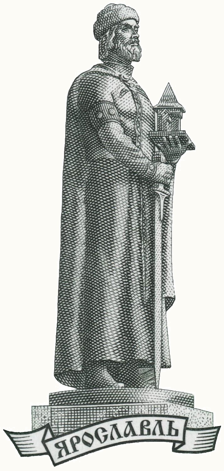 deeply involved in The Knight Templar in France and Palestine. The oldest settlement on the territory of modern-day Yaroslavl belongs to the 5th – 3rd millennium BCE. Apparently, Kazan and Yaroslavl are the oldest of all the currently existing cities on the River Volga. The name Yaroslavl sounds related to Yaruslim, the capital of Lemuria.
Magazine “World Channeling” states that in the sky over Yaroslavl, in subtle plans, there is the Yaroslavl Temple. This is one of the most important places and points of the planet, existing in many worlds and dimensions. Portals of a huge number of galaxies and civilizations flock here.
Yaroslavl is a multi-level temple. It is possible to decipher the name of the city of Yaroslavl as “the glorification of the Spring Sun”: YAR means “the Sun”; SLAVL means “to praise”. However, here there is a shortened version of the name of the Sun. The hidden meaning is YARUN (YARILO), which in meaning is the Central Spiritual  Sun, and not the Sun of the Solar System itself. Yaroslavl is the point of the Earth, which has always been directly connected with the energy flows of the Central Spiritual Sun. The bear is the ancient symbol of Yaroslavl, like Russia’s. According to a legend, when Yaroslav the Wise came here to baptize the local residents, he had to
  deal with their sacred and worshiped bear. It happened at the confluence of the Volga and the Kotorosl River.
While many bearers of the Imenkovo culture went from the territory of present-day Tatarstan to the territory of modern Ukraine, some of them remained in place and merged with the incoming nomads Bolgarians, and influenced their culture and economy, in particular the development of agriculture. The Bolgarians were migrating from the region of Azov Sea after the dissolving their Great Bolgaria (Great Bulgaria), existed in mid-7th century between the River Dniester and lower Volga, (modern southern Ukraine and south-west Russia). The original capital was Phanagoria on the Taman peninsula between the Black and Azov seas. The first major part of Bolgar tribes (Orda) led by khan Asparukh moved to the north-eastern Balkans, to the River Danube. In 681, these Bolgars formed with the local South Slavic tribes the First Bulgarian Empire. The second major part of Bolgar tribes moved to the Middle Volga and formed the Volga Bolgaria. From these medieval times, Bulgaria on the Danube River is the direct relative with Bolgaria (Bulgaria) on the Volga River. There is a hypothesis that the original name Bolgar is connected with Russian / Slavic name Volgar that means a person from the Volga River.
Still not everyone in the scientific world agrees with the Slavic ethnic attribution of the Imenkovo culture, and often this is based not so much on scientific caution, but on political reasons. The largest scientists believe that the Imenkovo culture was formed by the bearers of the ethnonym Rus. These Russians leaved precisely from the lands where these Imenkovo tribes lived, and formed a new Volyntsevo culture that formed the above mentioned Kiev (modern capital of Ukraine and former capital of Kievan Rus, a loose federation of East Slavic tribes existed from the late 9th to the mid-13th century. The question “Where did the Russian land come from?” receives a precise answer. Most scientists know this, it was the Middle Volga. The Imenkovo culture began the development of the Volyntsevo culture of the Middle Dnieper. The Imenkovo culture is Rus. Hence, the land of present-day Old Maina and the basin of River Maina can be considered the very territory from which the Russian land (state) came from.
The source of the river Maina is located over 50 km west from Old Maina, on the territory of Tatarstan (often associated with Tartarus), close to the border with the Ulyanovsk region. Actually, the River Small Maina (tributary of river Maina) is the line of border between the Republic of Tatarstan and the Ulyanovsk region. The source of the river Maina is in the Spassky District of Tatarstan. The main attraction of this district and its  administrative center is the town of Bolgar, located on the left bank of the Volga River, like Old Maina. The distance between Bolgar and Old Maina is 40 km.
Bolgar was the medieval capital of Volga Bulgaria from the 8th to the 15th centuries. It was a big international trade center, linking the East and the West by the Volga trade route. Traders from China, Baghdad, Damascus, Spain, Scandinavia, Rus and other countries used to come to Bolgar. Many foreign trade concessions had their settlements and streets in Bolgar. It is stated that Bolgar was bigger than Paris and London. Bolgar is a World Heritage Site declared by the UNESCO World Heritage Committee.
 Bolgal has special religious significance for the Muslims of Russia and the Volga river regions in particular. Islam was adopted here in 922 and it became official religion of the Volga Bulgaria. Special embassy arrived from Baghdad then capital of the Caliphate ruled by the Abbasid dynasty. The spread of Islam in the Middle Volga region was peaceful. The Volga Bulgarians knew One God from their pre-Islamic religion called Tengrism. The adoption of Islam by the Volga Bulgaria led to a strong impetus to the development of education, literature, and science. The Bolgars achieved considerable success in mathematics and astronomy, chemistry and medicine, geography and history. From the Soviet times, pilgrimage to Bolgar is called the Little Hajj.
Today, Islam is the religion of about 1,5 billion inhabitants of the Earth. It  is more than 22% of the world’s population. The largest Koran is kept in Bolgar. The Volga Bulgaria was the only Islamic country of Eastern Europe. The Bulgarian Historical and Architectural Museum-Reserve (established in 1969) is the most northern monument in the world of medieval Muslim architecture. Being secular, the leadership of Tatarstan places a key importance on the development of historical and religious heritage. Bolgar is identified with Islam, whereas Sviyazhsk is recognized as the first Christian center in Tatarstan.
Sviyazhsk is located at the confluence of the Volga and Sviyaga Rivers. The source of the River Sviyaga (375 km) is located in the Ulyanovsk region, on the right side of the Volga, 60 km south from the urban settlement Maina.
New Maina (Russian: Novaya Maina) is an urban type settlement of the Ulyanovsk region. New Maina is located 70 km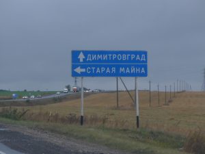 southeast of Old Maina, and 90 km southeast of Ulyanovsk. Only 9 km is to New Maina from the city of Dimitrovgrad.
 New Maina and Dimitrovgrad are divided by the river called the Big Cheremshan (Russian: the Bolshoy Cheremshan River), a tributary of the Volga River.
Cheremshanka is the name of a number of settlements in Siberia, including Krasnoyarsk Cheremshanka Airport, located 25 km north of the mouth of river Mana. Between them there are two creeks named Big Arey and Small Arey. They are tributaries of the Kacha River (tributary of the Yenisei River). Arey and Arya refer to the Aryans lived here thousands years ago. In Sanskrit, “kaccha” means “watery soil”, “a bank or any ground bordering on water”, “shore”, “a mound or causeway”, etc. Beside the Kacha River in Krasnoyarsk in Southern Siberia, Russia has settlement and river Kacha in Crimea, where it enters the Black Sea near Sevastopol.
Being the second-largest city of the Ulyanovsk region (“the motherland of Lenin”), Dimitrovgrad was named in 1972 celebrating the posthumous 90th birthday of Georgi Dimitrov, the first communist leader of People’s Republic of Bulgaria. It is also symbolic taken into account that the Volga Bolgars (Bulgars) and the Bulgarians divided in 7th century to establish first Bulgarian state on the Danube and another on the Volga. Dimitrov ruled Bulgaria from 1946 to 1949. He led the Moscow based Communist International from 1934 to 1943. He expanded Lenin’s ideas by stating that fascism was the dictatorship of the most reactionary elements of financial capitalism.
Russian Dimitrovgrad is twinned with Bulgarian Dimitrovgrad. Also, Dimitrovgrad of the Ulyanovsk region is twinned with city of  Obnisk (the Kaluga region), the place of the world’s first nuclear power plant to generate electricity for a power grid.
Founded in 1714, modern Dimitrovgrad is a prominent nuclear center of Russia. The city’s leading enterprise is the country’s Federal Nuclear Research Institute. One of the institute’s atomic reactors provides Dimitrovgrad with district heating.
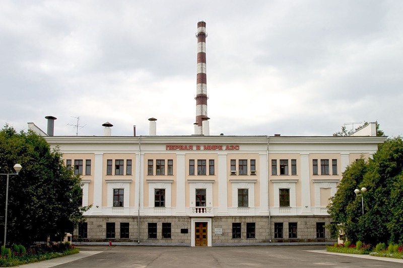
Obninsk. The world’s first nuclear power plant
Unlike the US military who dropped in 1945 two nuclear bombs on the Japanese cities of Hiroshima and Nagasaki (located near the 33rd parallel), Russia (then the Soviet Union) pioneered peaceful use of atomic energy. Russia built the first nuclear power plant on the planet that started in 1954 producing electricity for Moscow region. It was the first nuclear power plant in the world connected to national power grid. This reactor in Obninsk (the Kaluga region) was stopped in 2002. Today the station is a memorial museum of the nuclear industry in Russia. This world’s first home of a peaceful atom is open to visitors and tourists.
Symbolically, Kaluga is the place of Russian rocket scientist Konstantin Tsiolkovsky (1857 – 1935) who is the founding father of modern rocketry and astronautics. His works inspired leading Soviet rocket engineers, including Sergei Korolev the father of practical astronautics, who was in charge of the development of the R-7 Rocket and launching into Cosmos the first man (Yuri Gagarin) and later the first woman (Valentina Tereshkova, born near the above mentioned Yaroslavl).
Dimitrovgrad also has the State Scientific Center of Russian Federation, Research Institute of Atomic Reactors. The farther of Russian nuclear program and the peaceful atom Igor Kurchatov (1903 – 1960) was born in the Urals, the natural border between the East and the West, and the most sacral place on the planet.
Dimitrovgrad / New Maina are located 110 km north of Samara. It has given its name to the Samara culture, a neolithic culture of  the 5th millennium BCE. The Samara region is considered as the original homeland of the Proto-Indo-European language.
Samara is one of the largest cities in the Volga River, and the 6th largest city in Russia. Samara is a major international transport hub. Its railway station is the tallest in Europe.
Samara’s most prominent symbol is the Monument of Glory, overlooking the Volga river. It is a man with wings raised over his head, standing on the pedestal symbolizing ray of light rising to the sky. The city is well known in the world for the production of aerospace launch vehicles, satellites, various space services, engines, aircrafts, etc. Samara has been one of the largest Russian aircraft manufacturing centers. It is the home of the Samara Research Center of the Russian Academy of Sciences and Samara State Aerospace University, one of Russia’s leading engineering and technical institutions.
During the Great Patriotic War / Second World War (1941 -1945) Samara was the reserve (second) capital of the Soviet Union. Highly 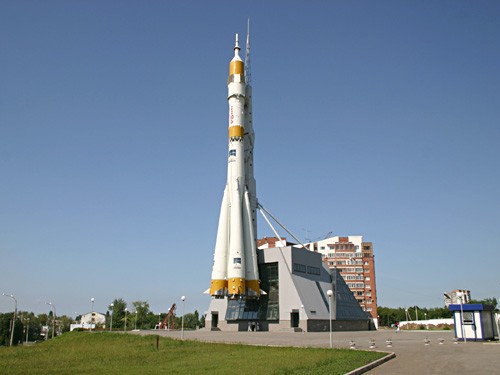 secretive bunker of its ruler Josef Stalin is now open to the public. After the war, Samara became the Cosmic capital of the Soviet Union. In Samara was built the launch vehicle Vostok, which delivered in 1961 the first manned spaceship to orbit with Yury Gagarin on board. After returning to Earth / landing near the great Russian River Volga,
  Yury Gagarin, the first man to travel in Space, took a rest in Samara. Here he reported to the State Commission, headed by Sergei Korolev, on the successful completion of his historical mission.
It became a tradition for the Soviet astronauts to come to Samara after returning to Earth. Beside implementation of the space program, Samara enterprises have been playing a leading role in the development of aviation. One of its symbols is the above mentioned Ilyushin Il-2 ground-attack aircraft assembled in Samara in late 1942. During the World War II, Samara produced During produced over 15,000 of Il-2 of more than 36,000 built in the Soviet Union. So, the Il-2 remains to this day the most massive and effective combat aircraft in history. After the War, for more than half a century Samara produced Tupolev, Antonov and Ilyushin-designed aircrafts. The vast majority of Tupolev Tu-154 airplanes (over a thousand aircrafts), which formed the basis of the Soviet Union and Russia’s civil aviation from the 1970s to the early 2000s, were manufactured in Samara. A veritable icon of the Cold War, four-engine turboprop-powered strategic bomber and missile platform, Tupolev Tu-95 was also produced in Samara.
Near Samara in 1391 there was a great battle between the Samarkand ruler Tamerlan and Tokhtamysh, a descendant of Genghis Khan and a prominent khan of the Golden Horde (Orda). This confrontation had a huge impact on the history of Eurasia.
Tamerlan (“The One Who Knows Merlin”) had the symbol of Shambala as his personal seal. According to the Roerichs, who worked with the Mahatmas of Shambala, Tamerlan owned the Cintamani Stone received from the Shambala. This Stone was originally a gift from Orion and considered responsible for spiritual evolution on Earth. Chintamani strengthens the power of the owner, contributing to victory in any endeavor. Cintamani was in the hands of Solomon, Alexander the Great, Genghis Khan, Tamerlan, Akbar the Great, Napoleon, the Roerichs. The country where the Stone arrives, receives the special protection of the Brotherhood of Light.
It is stated that due to such protection, Tamerlan never lost a single battle. Tokhtamysh was indeed his strong opponent. These two armies were the strongest in Europe and Asia at that time. Even after two severe defeats from Tamerlan, Tokhtamysh was able to pull together his Golden Horde to resist and attack again.
The Horde’s military power peaked during the reign of Uzbek (1312–1341), who adopted Islam and ruled from capital Sarai-Batu in the lower part of the Volga River, 100 km north from modern city of Astrakhan, where the Volga River begins to enter the Caspian Sea. The territory of the Golden Horde at its peak included most of Eastern Europe from the Urals to the Danube River. It extended east deep into Siberia. The Golden Horde’s lands incorporated the Black Sea, the Caucasus Mountains, and bordered the territories of present-day Iran and Azerbaijan, ruled by the Mongol dynasty known as the Ilkhanate. Iran (literally “the country of Aryans”) and Northern Azerbaijan are related to the Manna Kingdom existed there in the 1st millennium BCE.
New Maina is located in the lower parts (close the mouth) of three rivers: the Big Avral, the Small Avral, and the Dry Avral. In Sanskrit, Avirala means “compact”, “contiguous”, “dense”, etc. New Maina was founded in the second half of the 18th century. Before the 1917 Revolution, New Maina was a district containing a number of villages. Its status of urban type settlement New Maina got in 1973. Symbolically, 73 is the car code of Ulyanovsk region (for number plates).
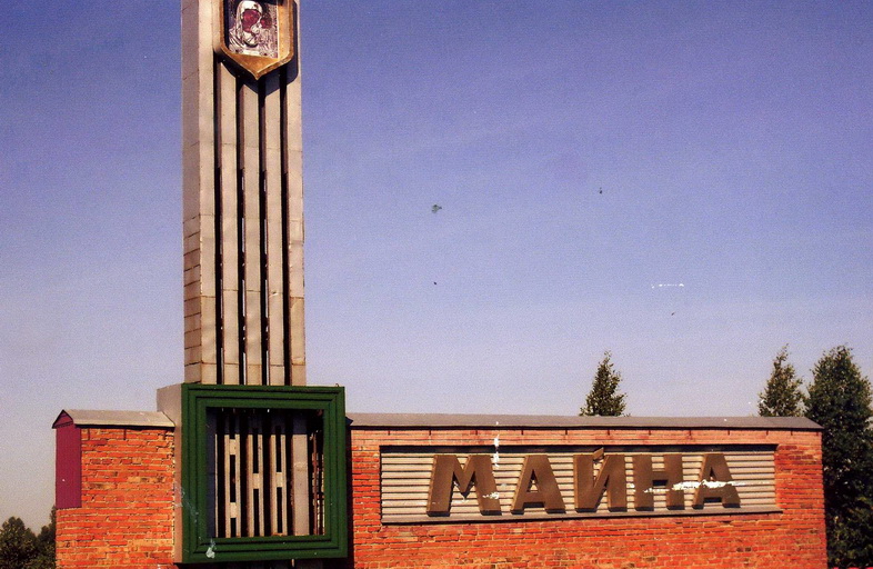 The above described settlements Old Maina and New Maina of the Ulyanovsk region are located on the left bank of the River Volga. On the opposite right bank of the Volga, there is also settlement Maina and river Maina. This urban type settlement Maina is 50 km west south of Ulyanovsk, whose historical center is also on the right bank of the Volga. Interestingly, in Southern Siberia also there is settlement called Maina.
Maina is administrative center of the Maina district of Ulyanovsk region. In the vicinity of the settlement are the sources of the rivers Maina and Berezovka. Interestingly, beside the link to the Russian name of the Birch (Bereza), the term Berezovka (Bereza) could be also connected to the Hara Berezaiti (literally meaning “High Watchpost”) given in the Avestan language to a legendary mountain around which the stars and planets revolve. Indeed, the Ulyanovsk region is a part of the Volga Uplands (Volga Hills) that are also famous for their unreal beauty.
The Avestan language is the language of Zoroastrian scripture of the Avesta. There is a hypothesis that Zoroaster was born near modern Russian city of Perm, the Urals region. Perm is located on the Kama River (Sanskrit name), 630 km north east of Ulyanovsk. The River Kama meets the Volga River 110 km north east of Ulyanovsk. The mouth of Volga is the Caspian Sea linking modern Russia and Iran.
 The Avestan language is classified as an Iranian language, a branch of the Indo-Iranian languages within the Indo-European family. The Avestan is assumed to have been quite close to Vedic Sanskrit. In Russia there are many names of rivers and settlements translated from Sanskrit. For instance, in the Ulyanovsk region is the source of river Sura. In Sanskrit, Sura means “water, sage, sun, divinity’”.
160 km west of the source of the River Sura is the source of another Sanskrit name River Moksha, literally meaning “Nirvana”. The source of the Sura River is 90 km west south of the settlement Maina and the sources of rivers Maina and Berezovka.
The River Maina is the Volga’s drainage basin: the Maina (23 km long) → the Barysh (247 km long) → the Sura (841 km long) → the Volga (3,692 km long) → the Caspian Sea.
 70 km northwest from Maina is the settlement
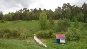
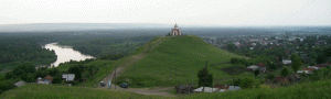
 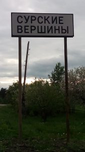 Sura Peaks (Russian: Surskiye Vershiny). This place is famous for its St. Nicholas Hill overlooking the River Sura. It is one of the most revered destinations in the Sura district and the whole Russia. It is believed by everyone claimed the 76-meter hill will be freed from all the sins. This St. Nicholas Hill is made of chalk. Its slopes are very steep, covered with grass and rare bushes.
40 km north of St. Nicholas Hill / the settlement Sura Hills is located city of Alatyr, founded in 1552 near the conjunction of the River Alatyr and the Sura River.  Alatyr, like the settlement Sura Hills, was established by the order of the first Russian Tsar Ivan Grozny going to conquer Kazan.
Anagrams of Alatyr (or vice versa) are: Altair (the brightest star  in the Aquila constellation), Altar (the ‘Holy table’, structure for religious sacrifices located in places of worship), etc. Altai Mountain is the most sacred place in Russia. In the Russian medieval legends and folklore, Alatyr-stone is a sacred stone, “the father to all stones”, and the navel of the Earth, containing sacral writings. The Alatyr-stone is endowed with healing and magical properties. In the spiritual verses it is stated that from beneath the Alatyr-stone originates a wonderful source that gives the whole world sustenance and healing.
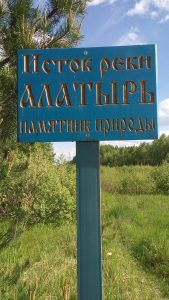 The source of river Alatyr is 190 km west of its mouth. The Alatyr originates in the Nizhny Novgorod region, near town of Sarov, most known for its St. Seraphim of Sarov and the Russian center for nuclear research. Sarov is a sister city to Los Alamos, the home of the U.S. nuclear weapons design laboratory. The scientists of Sarov (former Arzamas-16) and Los Alamos have cooperated on various arms control and nuclear safeguards programs. The Russians playfully called their own center «Los Arzamas».
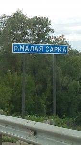 Between St. Nicholas Hill / the settlement Sura Hills and city of Alatyr is located village Sara and two Sarka rivers: The Big Sarka and the Small Sarka. Sarka is a diminutive of Sara (river). In Sanskrit, Sara means “essence”, “stream”, “energy”, “main point”, etc. The Middle Eastern name Sarah means “Princess”.
The Sara River is also in the center of Moscow, although now it is enclosed in a tube. This Sara is a tributary of the Moscow River. In Yaroslavl region of Russia, 180 km northeast of Moscow, the Sara River enters the Lake Nero, whose name is related (or vice versa) with the surname of Jawaharlal Nehru, the first Prime Minister of independent India. His daughter Indira Gandhi and grandson Rajiv Gandhi were also Prime Ministers of India and central figures in Indian politics.
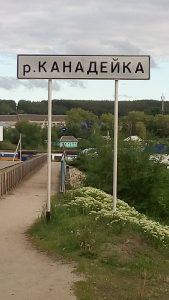 100 km south of Maina, 45 km southwest of the source of the Sura River is the settlement of Kanadei that is quite close to the name Canada and the surname Kennedy, or vice-versa. The most famous romance of John F. Kennedy was with Hollywood actress Marilyn Monroe. She was made a star by the founder of Hollywood, a former Russian subject Joseph Schenck, born in Rybinsk, located in the Upper Volga. Talent of Monroe was developed by her Russian teachers who found themselves in America.
Kanadei is located in the conjunction of the River Kanadeika with the Syzranka River. A tributary of the River Kanadeika is Ardovat. Also, Ardatov is a Russian town located 20 west km of Alatyr.
40 km north from Kanadei is the source of Sviyaga River, a tributary of the Volga River. In the city of Ulyanovsk, the Sviyaga River (375 km long) flows only a few kilometers away from the Volga River (3,692 km long), but their confluence is 160 km north of Ulyanovsk, in Tatarstan. Tsar Ivan Grozny built in the 16th century in the mouth of Sviyaga River a fortress Sviyazhsk.
200 km west of Kanadei is the source of Sanskrit named river Moksha, literally meaning Nirvana. The River Moksha is a tributary of the River Oka, the Volga’s drainage basin.
The River Kanadeika is also the Volga’s drainage basin: Kanadeika (57 km long) → the Syzranka River (168 km long) → the Volga (3,692 km long) → the Caspian Sea.
Kannada is a Dravidian language spoken predominantly by Kannada people in India, mainly in the state of Karnataka, having deep ties with Russia, including the state symbols, the Roerichs, Helena Blavatsky, еtc. It is believed that the name Karnataka, translated from the local Kannada language, means “an elevated country”. It is also the true for the Russian settlement Kanadei and the River Kanadeika, located in the Volga Hills (the Volga Uplands). The source of the River Kanadeika is only 22 kilometers south of the settlement Sura Peaks (Russian: Surskiye Vershiny), where the Sura River originates.
The son of the god Surya, Karna is one of the central heroes of the Mahabharata. He is the embodiment of strength, valor and honor. In Sanskrit, “karna” means “eared”. In Russian there is surname Karnaukhov having same meaning. In Kemerovo region, a man with surname Karnaukhov is said to have discovered the famous Tisulsky Princess.
The Ulyanovsk region has many Sanskrit names crucial to Indian culture, founded by the Aryans came from the territory of modern-day Russia. If read from right to the left in Arabic, Rusia (Russia) becomes Suria. It is not only the Arab-speaking country of Syria, but also the above described Vedic god Surya and Russian River Sura.
100 km south from Ulyanovsk or 90 km southeast of Maina is mysterious equilateral triangle (roughly with sides 15 km * 15 km *15 km) in the hills covered by beautiful pine forest, widely known for unusual gardens of huge bizarre-shaped stones, curving of space and time, strong natural energy coming from the Earth around the so called Devil’s finger, underground passageways, sudden appearance of UFO and aliens, etc.
Near this triangle, was born Ivan Dmitriev (1760 – 1837), a famous Russian statesman, member of the Russian Academy, and poet. By the personal invitation of Emperor Alexander I, he served as Minister of justice from 1810 to 1814. Ivan Dmitriev underlined the intrigues, following first of all the law. Due to his honesty he got into many conflicts with influential dignitaries. However, Alexander I highly respected him. Also, Ivan Dmitriev was a distant relative of Nikolay Karamzin (1766–1826), the “father of Russian history”.
In Southwestern Russia there are two rivers with the root “Man”: the East Manych (basin of the Caspian Sea) and the Western Manych (basin of the Azov Sea).
The East Manych (141 km long) and the Western Manych (420 km long) both originate in the Republic of Kalmykia, located in the southwestern part of European Russia. A small part of the Volga River flows through eastern Kalmykia. Also, Kalmykia is washed by the Caspian Sea in the southeast.
The distance between the sources of both Manych Rivers and the Caspian Sea is about 250 km. There are many legends about the Manych River. According to old scriptures it flowed from the Caspian Sea. There is an assumption that in ancient times the Manych River was a large strait that united the modern Caspian Sea and the Black Sea.
The salinity of the lakes in the basin of the River Manych indicates the existence of a connection with the sea basins. Presumably, the strait ceased to exist 3,000 years ago. However, for a long time the ancient tribes used Manych as a navigable artery connecting the Azov Sea coast (the Don delta region) with the Caucasus. By the Manych, goods were transported from China, Persia, Turkestan and India, merchants sailed from the Caspian. The Phoenicians (known for their marine and trading skills) sailed to the Caspian Sea along the Manych strait. In the middle of the 19th century, fragments of an ancient sea vessel of supposedly Phoenician origin, made of cedar wood with copper nails, were washed in the shore of Manych.
Interestingly, Kalmykia is the only region in Europe where Buddhism is the most practiced religion. The majority of the Kalmyks follow Buddhism, like their ancestors, the westernmost group of the Mongols whose ancestral home is in the Altai region of western Mongolia. They migrated from the steppes of Southern Siberia to the Lower Volga region in 17th century and became subjects of the Russian Tsar. They duty was protecting Russia’s southern border.
The Western Manych, often called just Manych (420 km long) is tributary of Don (1,870 km long), one of the major rivers of Russia and the 5th longest river in Europe. The Volga and the Don are the two main waterways of the European part of Russia. They approach each other in the modern-day Volgograd region. The importance of connecting the Volga and the Don by means of a canal was clear as early as the Middle Ages. The earliest attempt to link them, dates back to 1569, when the Turkish sultan Selim II sent 22,000 soldiers to dig a canal between the two rivers. The Turks gave up after a month of work. Selim II or Sarı Selim (“Selim the Blond”) was a son of Suleiman the Magnificent and Hurrem Sultan, often called Roxelana, one of the most powerful and influential women in Ottoman history. Hurrem means “the cheerful one” in Persian, but she was Russian, from the territory of modern-day Ukraine. By large, the Russians, the Persians, and the Turks have the Aryans as their ancestors.
Another attempt to connect the Volga and the Don was made by the Russian Emperor Peter the Great (1672 – 1725), who defeated the Turks in Azov (mouth of the Don) in 1696. The canal was partially completed by the end of 1701, but the Russo-Swedish war broke out, and the Emperor had to abandon the project.
Only the Soviet Union was able to realize the old dream of linking the two great rivers  that connect five seas: the Baltic, White, Caspian, Azov and Black seas. Shipping Volga – Don Canal named after Lenin was opened in 1952 in Southwestern Russia. The canal’s length is 101 km. It connects the Volga River and the Don River at their closest points. The canal starts south of modern Volgograd (Fortress of the Volga), where the lower course of the Don approaches the lower course of the Volga.
Volgograd (former Stalingrad) is a hero-city. It is famous for its heroic resistance to the Nazis and the bitter defeat of the Naz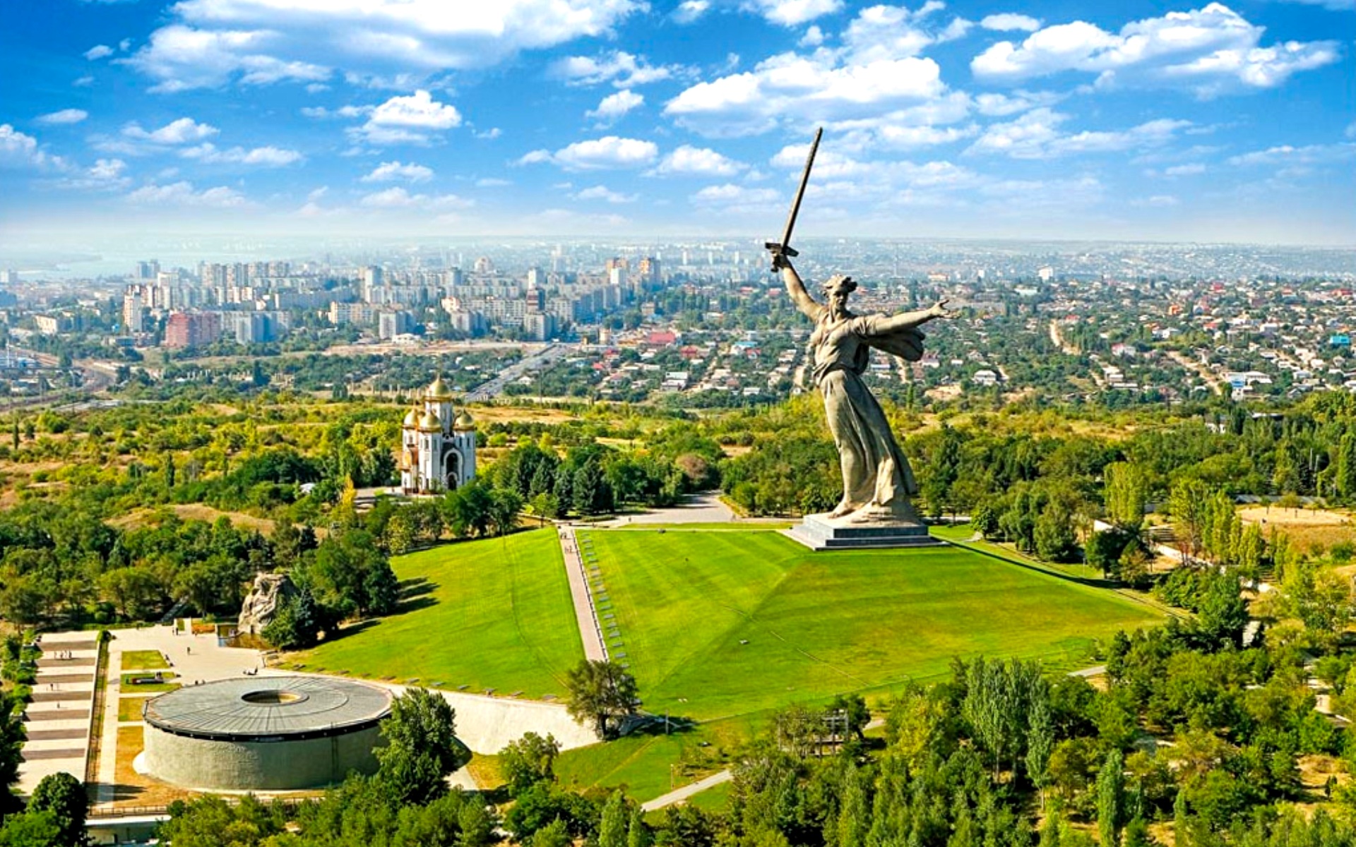 is from the Soviet defenders during the Battle of Stalingrad (August 1942 – February 1943) that was the largest and bloodiest battle in the history of warfare.
In the mouth of the Manych is the settlement Manych (Russian: Stanitsa Manychskaya) named after the river. Initially, it was a fortress founded by the Don Cossacks in 16th century to fight against the Ottoman Turks occupied their land. At that time the Don Cossacks enrolled on the service to the Russian Tsar Ivan Grozny and the whole Muscovy or Rus.
Interestingly, the name of Osman I (1299 – 1324), the founder of the Ottoman Empire, might be related to Atman or Ataman. It is the original title of Cossacks’ leader. According to Ottoman tradition, Osman’s father led his tribe west from Central Asia into Anatolia, fleeing the Mongol onslaught. Central Asia is the home land of the descendants of the Aryans. Although they speak different languages now and live in different countries, genetically they share the common ancestor.
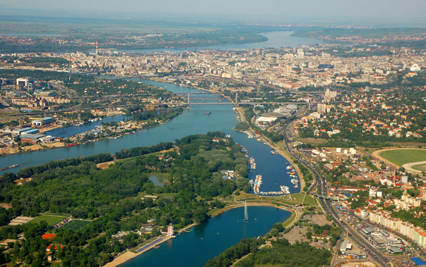
The settlement Manych is located 40 km east of the city of Rostov-on-Don, a major international transport center, a port of five seas: the Black Sea, the Sea of Azov, the Caspian Sea, the White Sea, and the Baltic Sea. Rostov-on-Don is and the administrative center of the Southern Federal District of Russia and also often referred as the “gateway to the Caucasus”. The main city Cathedral of Virgin’s Nativity was designed by Konstantin Ton (1794 – 1881), an official architect of Imperial Russia during the reign of Nicholas I. His most prominent works include: the Cathedral of Christ the Saviour (with mysterious Elohim on the main dome), the Grand Kremlin Palace and the Kremlin Armoury in Moscow.
Rostov-on-Don and nearby city of Tagangor are the places of the Southern Federal University (founded in 1915). It is a large scientific and educational center of Russia. In 2016, the university entered the rating of the best universities in the BRICS countries.
Besides being a large educational center, Rostov-on-Don is a worldwide center for helicopter and farm machinery manufacturing.
Rostvertol (founded in 1939) is a leading Russian helicopter manufacturer company located in Rostov-on-Don. It has been
producing helicopters designed by the Mil design bureau since 1956 and is a world leader in the manufacture of heavy-lift helicopters. The plant also produces unique combat attack helicopters, operated in many countries.
 Rostselmash (founded in 1929) is a Russian agricultural equipment company, based in Rostov-on-Don. It is one of the five largest world producers of agricultural machinery. Beside Russia, Rostselmash has production facilities in Canada, USA, Ukraine and Kazakhstan.
Novocherkassk Electric Locomotive Plant (founded in 1936) is the largest Russian manufacturer of electric locomotives and 
Beriev Taganrog Aviation Scientific Technical Complex (founded in 1934) is the world leader, specializing in amphibious aircrafts.  Throughout its history, it has designed and produced more than 20 different models of aircraft for civilian and military purposes, as well as customized models. Pilots flying Beriev seaplanes have broken 228 world aviation records.
Then Beriev Design Bureau was moved to Krasnoyarsk in Southern Siberia in 1942 to avoid destruction in World War II, and returned to Taganrog in 1945. Near Krasnoyarsk is the mouth of river Mana.
A pioneer of amphibious aircraft was an Italian-born Soviet aircraft designer and scientist Robert Bartini (1897 – 1974), alumni of Polytechnic University of Milan. He lived and worked in Taganrog (50 km of Rostov-on-Don). “Every 10-15 years the cells of the human body are completely renewed, and since I lived in Russia for more than 40 years, I did not have a single Italian molecule left”, wrote Bartini. He influenced many Soviet aircraft engineers, particularly the future “father of Soviet Space program” Sergei Korolev who named Bartini as his teacher. Bartini was connected with other prominent Soviet aircraft engineers such as Ilyushin, Antonov, Myasishchev, Yakovlev and many others. Bartini was one of the most famous engineers in the Soviet Union, nicknamed Red Baron because of his noble descent. On the account of Robert Bartini are over 60 successful aircraft projects in the Soviet Union. Without Bartini, there would be no Sputnik, the first artificial Earth satellite, launched by the Soviet Union in 1957.
In 1974, three months priory his death, Bartini made a report, in which he proposed aircraft carriers on hydrofoils. This aircraft carrier would be moving at the speed of 600-700 km/h, so that the aircraft could land without quenching speed. When Bartini made his report, shipbuilder Rostislav Alexeyev of Sormovo (Nizhny Novgorod), a prominent designer of hydrofoil ships and developer of ground effect vehicles, refused to make his report, citing the fact that his report was worse.
Taganrog is located in Taganrog Bay, the northeastern arm of the Sea of Azov. The direct distance between Taganrog and the mouth of River Don is 25 km. Often Taganrog Bay is perceived as a flooded estuary of the Don River. Rostov-on-Don is the main city on the river.
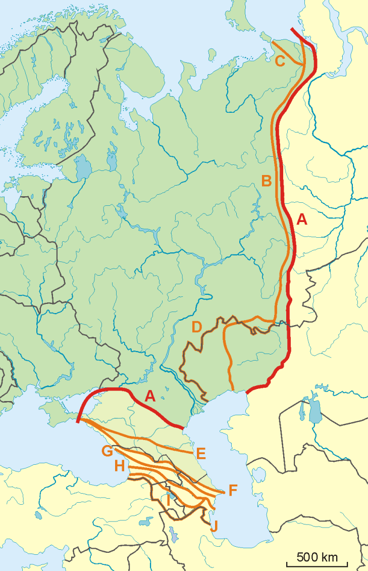 In antiquity, the Don was viewed as the border between Europe and Asia by some ancient Greek geographers. Indeed, the modern boundary of Europe and Asia is drawn by the Manych, a tributary of the Don. The border passes along the tops of the Ural Mountains and further along the Kumo-Manych depression, which is now the floodplain of the Kuma and Manych rivers, but in ancient times was a strait connecting the Black Sea with the Caspian.
There are two segments of the Asian-European border, which cause the bitterest disputes. This is a site to the south of the Ural Mountains (to the Caspian Sea) and a jumper between the Caspian and Black Seas. In the first case, the problem is caused by the fact that in the southern part of the Urals the ridge falls into several spurs. Still it is not accurately determined, which of them is to consider the border of Europe and Asia. As for the border section in the Caucasus region, there are also several opinions. Some scientists propose to draw a border along the Kumo-Manych lowland, others — along the watershed of the Caucasian Range, the third — to the south. It is obvious that the establishment of the border between Europe and Asia is not only a scientific, but also an administrative, and a political dilemma. By large, Asia is the home to the world’s first modern civilization, over 60% of total world population, and the largest economy of all continents.
Russia has parts in Europe and Asia. It is like balancing the Matter and the Spirit (ancient mystery), left and right hemispheres of human brain, male and female, etc. In order to solve the issue of Europe-Asia border, Russian scientists proposed to use not only geographical, but also political, and cultural-civilizational approach. The Asia Council (a forum for Asia’s heads of state or government and key decision makers) provides the most interesting facts about Asia.
According to Plutarch, the Don River (i.e. Europe-Asia border) was also home to the legendary Amazons of Greek mythology. During the times of the Scythians, near Rostov-on-Don (in the mouth of the Don) there was an ancient town and a major trading route known in Greek as the Tanais. This place (the Don River delta) Norwegian explorer Thor Heyerdahl has identified as the place of Asgard, the adore of Odin and his gods.
Internationally, Colchis is perhaps best known for its role in Greek mythology. It was the destination of the Argonauts, the home to Medea and the Golden Fleece. In more ancient legends, there is evidence that the legendary Argonauts, and later the ancient Greek  hero Hercules, searched for Colchis in the delta of River Don (the Azov Sea). Aea, later Colchis, was located in the lands of the Azov (not the Black) Sea. The name of Colchis was fixed by famous Ancient Greek lyric poet Pindar.
According to commonly spread tales, the Argonauts made their famous voyage to the shores of Colchis, located somewhere in the mouth of the Rioni River, flowing through the territory of modern Western Georgia (the Caucasus) washed by the Black Sea. However, this interpretation is not the oldest, and there are other texts. In the archaic, the most ancient versions of myths of the Argonauts, rooted in the 13th century BCE, the place of their action is the Don (Tanais), but not Rioni.
The authors, who composed their historical works in the Archaic time (at least 500 years before Hellenism), located Colchis in the delta of the Don River. In 13th century BCE, the real Colchis and its capital were located in the delta of the Don. In the 3rd century BCE, the memories of Aea / Colchis were transferred to Georgia. In the oldest myths, the Argonauts sought the Golden Fleece on the banks of the Don. Only in Hellenistic times, Greek and Roman poets began to localize Colchis in Georgia.
Kobyakovo hillfort
If the capital of Colchis had been on the territory of the Georgian Colchis, then archaeological evidences would have been in the place. However, so far archaeological science doesn’t know any cities of the Bronze Age in the Georgian Colchis, which could be identified with the legendary capital of the Colchis. On the other hand, in the delta of Don River such settlements are in abundance. One of the most famous is Kobyakovo hillfort, associated with the capital of the Colchis according to some ancient descriptions and archeological findings. Unique is the Kobyakovo archaeological culture of the Bronze Age, discovered on the eastern border of modern city of Rostov-on-Don. This city’s name has something in common with the name Frankfurt-on-Main. Interestingly, the distance to settlement Manych (the mouth of River Manych) from Rostov-on-Don / Kobyakovo hillfort is only 30 km.
Moreover, Kobyakovo hillfort has an exclusive layer of a relatively high civilization of the Copper Age, linked with the Aegean world of the Mediterranean Sea located between the Greek and Anatolian peninsulas, i.e. between the mainlands of modern-day Greece and Turkey. Copper, as provide by numerous extracted objects, was melted on the spot. The Copper Age existed before the Bronze Age. The Copper Age began in the late 5th millennium BCE.
The oldest securely dated evidence of copper making is 7,500 years ago. It has been discovered in an archaeological site in Serbia (motherland of Constantine the Great). The archaeological site of Belovode on the Rudnik Mountain in Serbia contains the world’s oldest securely dated evidence of copper smelting at high temperature from 5,000 BCE. Interestingly, the word “Rundik” (English: mine) is exactly the same in the Serbian and the Russian languages. Serbian Belovode fully correlates to the Russian term Belovode meaning Shambala. It is associated with Altai Mounties. In the past, Altai was among the major metal producing regions of Russia. The first capital of the Serbs was Ras (now a World Heritage Site) in Raska, a Serb medieval state, being centered in the region of Raška (hence its exonym). Serbs call southwestern Serbia, Kosovo and its former parts as Raska or Old Serbia.
Back in the 19th century, historians and archaeologists noted the fact that there was nothing like Kobyakovo archaeological culture in Russia or abroad. It is a phenomenon in the history of mankind, largely refuting the rights of Sumerians and Egyptians on creation of the first terrestrial civilizations. Moreover, the Sumerians and Egyptians stated that all their knowledge and essential technologies, including metalwork, were given to them by gods, i.e. representatives of highly developed civilizations.
Rostov-on-Don was named after the church of St. Dmitri of Rostov (1651 – 1709), located in the fort on the bank of River Don. St.  Dmitri was a prominent Russian Church theologian, Bishop of Rostov that is a town in present-day Yaroslavl region. The origin (etymology) of the word “Rostov” is uncertain. In the spoken Russian Rostov is pronounced as Rastov. In the ancient Egyptian Ra was sun god.
In pre- dynastic Egypt, Rushaa or Rasha (compare to Russia) meant Head or Headland. Located on the Nile meridian, the Giza Plateau was known as Rastau or Rostau. Giza was the place of the god Osiris, who was the Lord of the underground tunnels existing under the Giza Plateau. Being the early names for the Giza Plateau, Rastau also represented the shafts of the Pyramids that lead to the stars and mouth of the passages. Spiritually, Rastau or Rostau (quite close to Rostov or vice versa) symbolized portals between worlds. Chief Egyptian god Osiris was called Lord of Rastau. Interestingly, the residents of Russian Rostov were the founders of modern-day town of Veliky Ustyug where Egyptian Osiris has turned to Ded Moroz.
After all, the Kobyakovo hillfort located in Rostov-on-Don is not only one of the most mysterious points on the archaeological map of Russia, but also an anomalous zone. There are many legends, folk beliefs, and facts that cannot be explained.
For the first time the phrase “Kobyakovo hillfort” is found in a letter of July 7, 1570, by Ambassador Ivan Novoseltsev to Tsar Ivan Grozny. People lived on Kobyakov hillfort for millennia without a break. Only from 6th to 1st centuries BCE, there was a break for several centuries. It has been suggested that the year 23 of our era is the earliest date fixed by a reliable epigraphic monument of first mentioning the inhabitants of “ancient Rostov”. It is considered the starting point of the two thousand-year official history of Rostov-on-Don. Such a historical concept, although controversial, deserves attention.
In modern culture and literature, the Don region is also famous due to the epic novel “And Quiet Flows the Don” written by Mikhail Sholokhov (1905 – 1984), winner of the 1965 Nobel Prize in Literature. Sholokhov lived and worked in a rural locality (stanitsa) Vyoshenskaya, located in on the Don River, in the northern reaches of the Rostov-on-Don region. Today Vyoshenskaya is regarded as the spiritual heart of the Don region.
While the lower Don was well known to ancient geographers, its middle and upper parts were not mapped with any accuracy. The source of River Don was associated with the country of Scythes. The River Don originates in the modern city of Novomoskovsk, located in the Tula region, bordering the Moscow region that has many names translated from Sanskrit. Literally, Novomoskovsk means “New Moscow”. In Hindi, ‘Navi’ means ‘New’. New York and Russia have old ties, going beyond the general history. So does the name Tula or Thule, mentioned in ancient Greek and Roman literature and cartography. Tula / Thule is another name of Hyperborea (“beyond the North Wind”), more precise Arctic Hyperborea proposed in some exoteric writings to be the ancient origin of the Aryan race. It has nothing to do with Nazis and their Thule Society, who exploited this knowledge to justify their sinister deeds and crimes.
In a number of ancient sources, including the late Antiquarian and Roman texts, the Don River is called Sind. Exactly the same name was given on the ancient times to the river Sind in Hindustan. The Sindi were an ancient people in the Taman Peninsula, on Kerch Strait connecting the Azov Sea (the Don delta) and the Black Sea. Modern Sindh is a major province of Pakistan. Historically, Sindh is the home to the Sindhi people. Sindh’s capital Karachi has many “linguistic brothers” in Russia.
Based on the data of mythology and toponymy, established is the fact of transfer by the Aryans of geographical names from their Northern homeland (Northern Kuru, modern-day Russia) to their historical homeland Hindostan, a geographic term for the Indo-Gangetic Plain in northern India, broadly the Indian subcontinent, which later became an endonym. It is well known that the word Sindh is the basis for “Hind” of Hindustan. It is believed to come from the Persian (the Farsi). In the name Sind, S is pronounced as H in Farsi, so it became Hind. Hence, Sind → Hind → Hindustan. Overall, the Southern Siberia is considered to be the distant motherland of the Aryans, who created Vedic civilization in Hindustan and Avestan civilization in Iran.
Toponymy is at the junction of linguistics, history, and geography. Often, toponymy can say more than archaeological research. A lot of toponymy / hydronyms in the basin (interfluve) of the rivers Volga and Oka are practically identical with the names of sacred rivers and reservoirs in the Mahabharata, the first major Sanskrit epics of ancient India. The second one is Ramayaṇa. Interestingly, Ra was the earlier Scythian name of the Volga. In the works of ancient authors of the first centuries of AD, such as Claudius Ptolemy and Ammianus Marcellinus, the Volga was called Ra.
Ranha is “mythical stream” of the Avesta, the primary collection of religious texts of Zoroastrianism, whose founder is believed to be born on the Sanskrit named river Kama (the largest tributary of the Volga), near Russian city of Perm. Hydronyms, especially the names of large rivers, are the most stable in time. In Sanskrit, Rasa is “dew, juice, mythical river”. Exactly the same meaning has the Russian word ‘rosa’, often associated with God’s dew. The ToRah (the Old Testament) states that in the morning, after dew, appeared the Manna of Heaven.